FOOTHILLS FORESTS AND THE GATEWAY TO KANANASKIS
Bragg Creek sits along the eastern edge of Kananaskis Country, where the rolling foothills begin to rise toward the Front Ranges of the Canadian Rockies. The forests, creeks, and gentler ridgelines surrounding the community create one of the most accessible hiking regions near Calgary, and one of the easiest places to step into mountain-adjacent landscapes without committing immediately to higher alpine terrain. Alberta Parks’ West Bragg Creek and Elbow Valley information also reinforces that this is a heavily used, multi-season recreation zone with a broad range of trail options and relatively easy access from the city.
Bragg Creek hiking trails offer some of the most approachable foothills hikes in the region, with forest loops, creek valleys, front-range climbs, and lower-elevation routes that often come into season earlier than the classic alpine hikes deeper in Kananaskis. The terrain here is less about dramatic cirques and high passes and more about movement through mixed forest, open ridgelines, cutlines, creek drainages, and viewpoints that gradually open west toward the mountains. That lower-elevation character is one of the reasons these hikes are so useful. They work well in spring, in shoulder season, and on days when higher terrain feels too snowy, too wet, or simply less practical.
For many visitors and local hikers, Bragg Creek is not just a convenient option near Calgary. It is a natural transition zone between prairie and mountain travel, and often one of the best places to ease into a Rockies trip. If you want a broader look at the region itself, including how these foothills connect into the wider Kananaskis system, start with Kananaskis Country: Alberta’s Provincial Parks and Bragg Creek and the Foothills of Kananaskis. If you are trying to structure a bigger trip through the region, How to Plan a Trip to the Canadian Rockies is also useful context.
QUICK LOOK: BRAGG CREEK HIKES
Best viewpoint hike: Moose Mountain
Best forest hike: Fullerton Loop
Best longer ridge hike: Prairie Mountain
Best creek valley hike: West Bragg Creek Trail
Best quiet forest route: Merlin View
Best winter hiking route: Crystal Line Trail
FULLERTON LOOP
Distance in and out: 7 km
Elevation gain: 200 m
Time to complete: 2 to 2.5 hours
Difficulty: Easy to Moderate
Fullerton Loop is one of the most reliable foothills hikes near Bragg Creek because it combines accessibility, a moderate effort, and a satisfying sense of elevation without becoming a grind. Alberta Parks notes that once you are on the Fullerton Loop proper, you can either climb the ridge edge or take a more gradual route up the valley behind, and that choice says a lot about the hike itself. This is not a trail built around one dramatic payoff. It is a short, varied forest-and-ridge outing that feels flexible and approachable, especially for hikers who want a half-day in the foothills rather than a bigger mountain objective.
The trail spends much of its time under forest cover, but the ridge sections are what give it character. From those openings, the view reaches west down the valley and toward Moose Mountain, with the Elbow Valley unfolding below rather than the landscape exploding all at once into alpine scale. That foothills perspective is part of the appeal. You are not standing in the heart of the high Rockies here. You are watching the country transition toward them. Recent writeups also describe Fullerton as a good year-round option with sunset-worthy ridge views and modest elevation, which fits its reputation as one of the better shorter hikes in this part of Kananaskis.
For many hikers, Fullerton Loop works best as a first Bragg Creek hike, a shoulder-season outing, or a shorter day when the goal is simply to move well, enjoy the forest, and take in a few open views without committing to a bigger climb. It is a very good choice for people who want a comfortable foothills introduction before heading deeper into the region. If that kind of day sounds right, Private Half-Day Guided Hikes in Kananaskis is the closest match to the rhythm of this sort of outing.
PRAIRIE MOUNTAIN
Distance in and out: 7 km
Elevation gain: 700 m
Time to complete: 3 to 4 hours
Difficulty: Challenging
Prairie Mountain is one of the most popular climbs near Calgary because it delivers exactly what many front-range hikers want: a short approach, a sustained uphill effort, and a summit with big, immediate views. Alberta Parks describes it as an approximately 8.4 km out-and-back trail across from Elbow Falls in the Elbow Valley, and current route descriptions consistently note that its appeal lies in the combination of proximity, straightforward routefinding, and panoramic summit views stretching west to the mountains and east toward the prairie and Calgary.
This is not a gentle foothills wander. It is a climb, and it feels like one. Even with trail improvements and a more defined route than in older years, the day is still built around steady elevation gain. The line is obvious, the objective is clear, and the effort accumulates quickly. That makes Prairie Mountain appealing to hikers who want a short, strong workout with a meaningful summit rather than a lower-angle forest day. At the top, the views are broad in both directions, which is a big part of why the hike is so well loved. You can read the landscape clearly from up there: foothills dropping away to the east, bigger ranges building to the west, and the sense that you are standing on the seam between them.
Because of its steepness and popularity, Prairie Mountain is best for hikers who are comfortable with sustained climbing and who do not mind sharing the trail with others, especially on fine weekends. It works well as a focused half-day or shorter full-day effort, but it is not the hike I would choose for guests who want the day to feel relaxed from the start. If you are deciding between stronger effort days and steadier, more comfortable pace days, How to Pace a Hike in the Canadian Rockies is the most relevant supporting read.
MOOSE MOUNTAIN
Distance in and out: 14 km
Elevation gain: 550 m
Time to complete: 4 to 5 hours
Difficulty: Moderate
Moose Mountain offers one of the broadest viewpoint days in the Bragg Creek area, but it does so in a different way from Prairie Mountain. Where Prairie feels like a direct summit push, Moose Mountain is more about a longer progression through forest and onto a higher, more open ridge system. The surrounding trail network and Alberta Parks mapping show how this area connects into the wider West Bragg Creek and Moose Mountain corridor, and that helps explain why the day can feel more spacious and less singular than some of the shorter front-range climbs nearby.
The hike is well suited to people who want a more expansive foothills-to-mountain viewpoint experience without the same unrelenting steepness of Prairie. There is still effort involved, but the character of the day is different. Moose Mountain gives you a stronger sense of traveling through the landscape rather than simply driving yourself uphill toward a summit. Once you gain the ridge and viewpoint areas, the perspective opens toward both the Front Ranges and the foothills country, which is one of the reasons it remains such a rewarding objective near Calgary.
Because the summit area can also be accessed by road in season, not every Moose Mountain outing has to be treated the same way. Some hikers are there for a longer hike, others for a shorter viewpoint stop, and that flexibility changes the feel of the area. As a hiking objective, though, it remains one of the better choices when you want a fuller day with good views and a little more range than the shorter Bragg Creek loops. It is one of the clearer candidates on this page for a private full-day guided hike in Kananaskis.
WEST BRAGG CREEK TRAIL
Distance in and out: 8 km
Elevation gain: 150 m
Time to complete: 2 to 3 hours
Difficulty: Easy
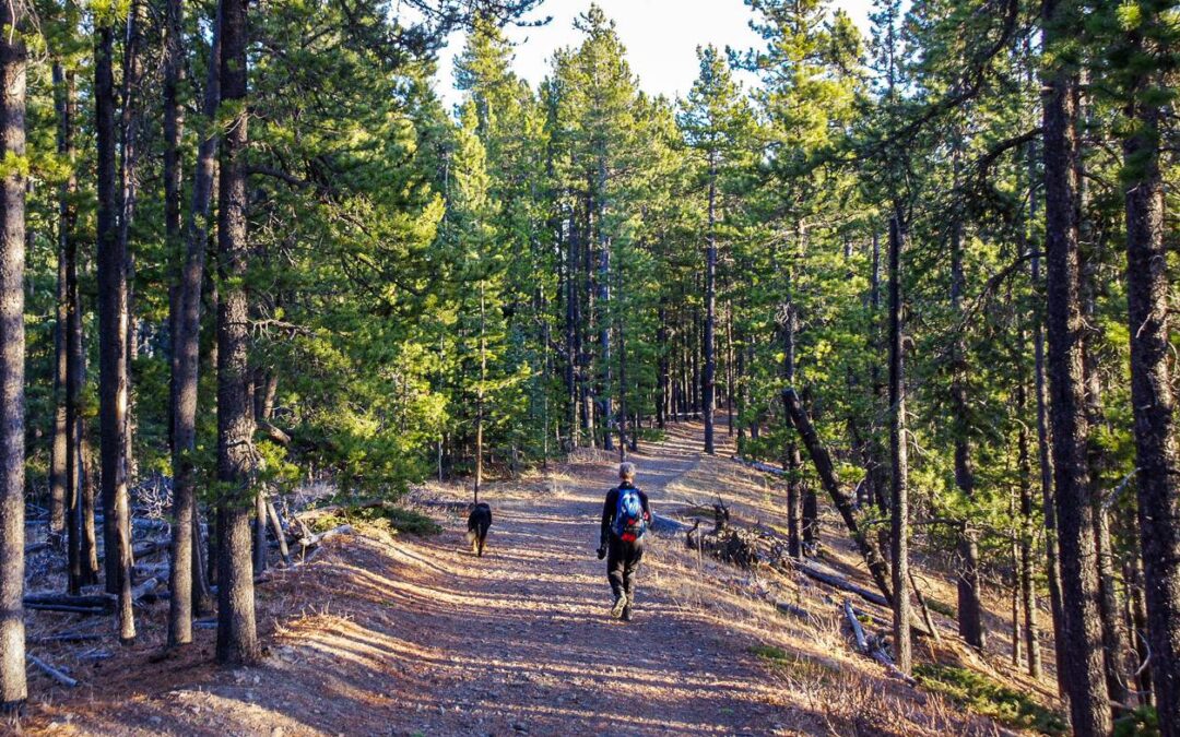
The West Bragg Creek trail network is less a single classic hike than a flexible foothills system built around forest travel, creek proximity, and all-season use. Alberta Parks notes that the All Season Trails system here was created in partnership with the Greater Bragg Creek Trails Association and emphasizes wildlife safety, shared use, and the breadth of the network. That is important context. This is one of the most developed and multi-use trail zones in the Bragg Creek area, and the experience is shaped as much by the network itself as by any one route.
For hikers, the appeal is simple: gentle grades, forest cover, well-used paths, and a low-stakes way to spend time in the foothills. The terrain is friendly, the navigation is generally straightforward, and the network can be adapted to shorter or longer outings depending on mood, season, and trail conditions. On a quiet weekday or a winter day with packed trails, it can feel like one of the easiest places in Kananaskis to get outside without overcommitting. On busy weekends, it is more social and more active, but still very accessible.
This is also one of the best areas for hikers who want a comfortable first outing after travel, a lower-elevation shoulder-season day, or a relaxed introduction to Kananaskis trails near Calgary. It is less about destination and more about usable, repeatable trail time in a forested valley system. If you are deciding whether this kind of foothills day is a better fit than a busier national park outing, Banff vs. Kananaskis for Hiking is a worthwhile comparison.
MERLIN VIEWPOINT
Distance in and out: 6 km
Elevation gain: 250 m
Time to complete: 2 hours
Difficulty: Moderate
Merlin Viewpoint is best understood as part of the West Bragg Creek network rather than as a classic standalone mountain hike. Alberta Parks has a Merlin View trail page, and recent user descriptions place it within the Braggin’ Rights and Merlin View loop area, with well-marked trails, mixed hiking and biking use, and an open viewpoint/meadow section that creates the visual payoff. That means the experience here is somewhat different from the more traditional out-and-back hikes on this list. It is a network-based outing, and that shapes the feel of the day.
The climb itself is not especially long, but the route gives you enough elevation change to feel like you have earned the opening when it comes. That opening is the reason most hikers remember it. After spending time under forest cover and moving through the more enclosed feel of the West Bragg system, the viewpoint provides a welcome sense of space. The foothills roll away below, and the western horizon reasserts the mountain backdrop that is often only hinted at lower down in the trees.
Merlin works well for hikers who want something a little more interesting than a flat valley trail but do not want a major climbing day. It is especially good if you already understand that part of the appeal in West Bragg is the network itself, the mix of forest and meadow, and the ability to shape a shorter outing without making the whole day about one summit objective. For readers who want a wider look at this side of the region, Bragg Creek and the Foothills of Kananaskis is the best internal companion page.
CRYSTAL LINE TRAIL
Distance in and out: 10 km
Elevation gain: 300 m
Time to complete: 3 to 4 hours
Difficulty: Moderate
Crystal Line is one of the more versatile Bragg Creek-area options because it holds its value across multiple seasons. Alberta Parks lists both summer and winter Crystal Line trails in the West Bragg Creek system, which supports its reputation as a good all-weather, all-season foothills route rather than a narrow summer-only objective. That matters in a place like Bragg Creek, where many hikers are specifically looking for trails that still work when the alpine is snowy, muddy, or simply less appealing.
The trail itself is primarily a forested outing. You are not on Crystal Line for constant big scenery. You are there for rhythm, consistent movement, and the way the forest softens wind and weather. That shelter is one of the reasons it can be a pleasant winter hiking or snowshoe option when more exposed trails feel less inviting. Small openings and shifting views toward surrounding ridges are enough to keep the landscape present without changing the essential feel of the hike, which remains rooted in foothills forest travel.
For hikers who like quieter, steady-moving days and who appreciate a trail that remains useful through a broader range of conditions, Crystal Line is a very solid choice. It is less iconic than Prairie Mountain and less destination-focused than some other routes, but that is also why it can be such a good fit for thoughtful pacing, winter fitness days, and lower-pressure outings close to Calgary.
ALLEN BILL POND LOOP
Distance in and out: 3 km
Elevation gain: minimal
Time to complete: 1 hour
Difficulty: Easy
Allen Bill Pond has long been one of the easiest low-commitment stops in the Elbow Valley corridor, and Alberta Parks still identifies Allen Bill as a year-round day-use area with picnic access in the Elbow River Provincial Recreation Area. The current site context matters a little here, because the “pond” experience is not quite the same fixed attraction it once was, and some local descriptions note that the old impounded pond character has changed over time. Still, the location remains useful as an easy outing, a short walk, and a simple foothills stop close to the river corridor.
This is not a hike people choose for athletic challenge. It is better understood as a relaxed foothills walk, a place to stretch the legs, or a softer beginning or ending to a day in the Elbow Valley. That can be valuable in its own right, especially for visitors just arriving from Calgary, families, or anyone wanting a calmer outing before heading toward bigger trails. The setting is modest, but it still carries that transitional foothills feel that makes this area useful for first-day mountain movement.
Allen Bill makes the most sense when viewed as part of the wider Bragg Creek and Elbow Valley mix rather than as a destination on the same level as the stronger hikes above. It is easy, accessible, and short, which is exactly why it belongs on a page like this.
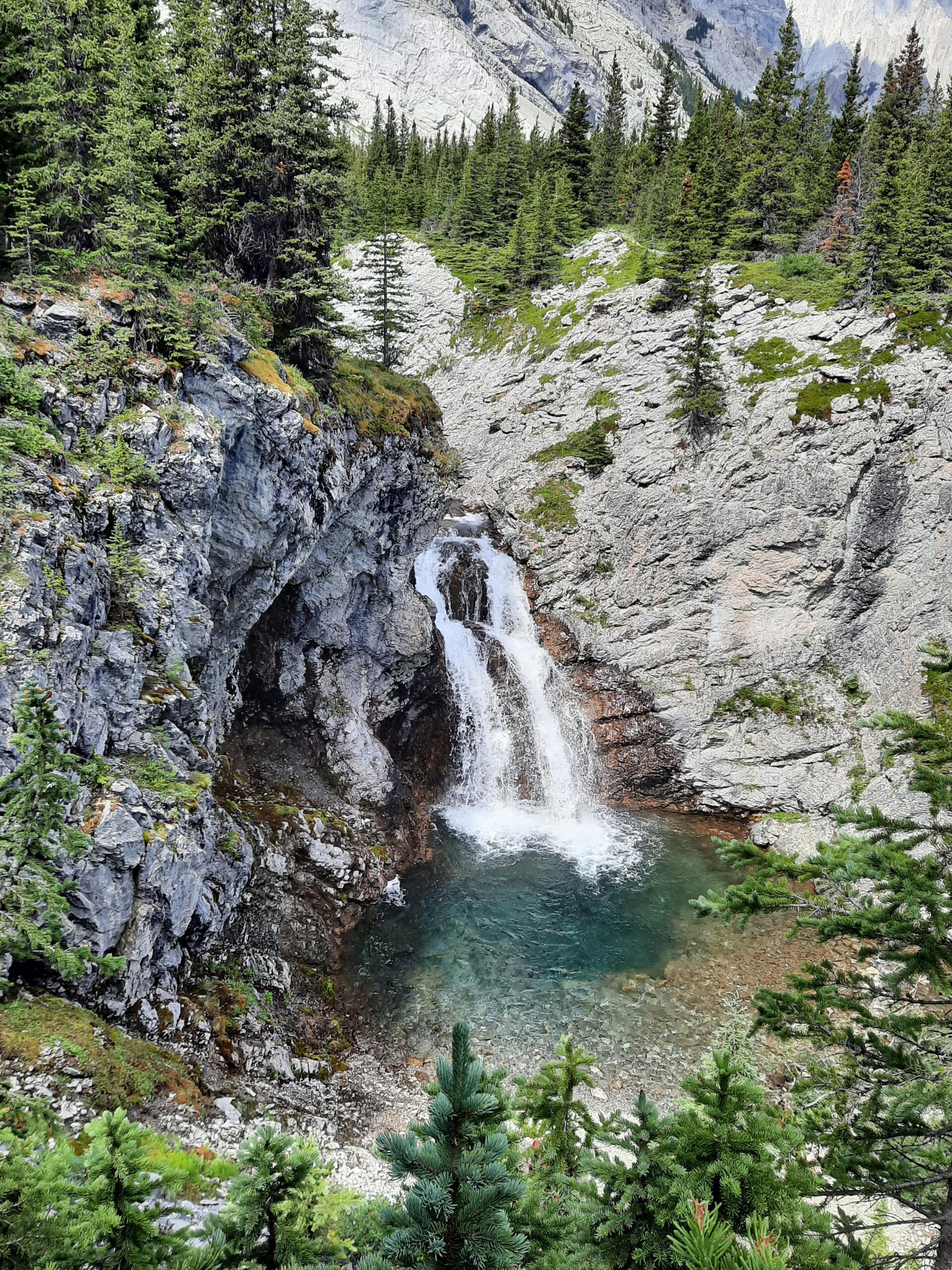
ELBOW FALLS TRAIL
Distance in and out: 1.5 km
Elevation gain: minimal
Time to complete: 30 minutes
Difficulty: Easy
Elbow Falls is one of the best-known stops in the foothills southwest of Calgary, and Alberta Parks confirms that the viewpoint and parking lot remain open even as the riverside interpretive trail is being replaced and upgraded. That current status is worth noting, because for many visitors this is not really a “hike” in the fuller sense so much as a short scenic stop with a very high reward-to-effort ratio.
What makes Elbow Falls memorable is the concentration of the scene. The Elbow River squeezes through the rock channel with a force that feels bigger than the short walk required to see it. The viewpoint is immediate, accessible, and visually strong, which explains why the stop remains so popular with people touring the area or combining several short foothills outings in one day.
As with Allen Bill, the value here is not in mileage. It is in access, scenery, and the ability to experience a very different kind of foothills landscape without major commitment. Elbow Falls works particularly well as part of an easier day, as a first taste of the region, or as a scenic stop when larger hikes are not the right fit.
WHY HIKE NEAR BRAGG CREEK INSTEAD OF BANFF?
Bragg Creek offers a different kind of mountain day from Banff or Lake Louise. The foothills here are lower, forested, and often easier to access from Calgary. Trails are generally less concentrated, the terrain is often more forgiving, and the day can feel calmer than it does in busier national park corridors. Alberta Parks’ West Bragg Creek and Elbow Valley information, along with current road-closure notices west of Elbow Falls in winter and spring, also reinforce how closely this area is tied to seasonal access and front-range recreation patterns rather than classic alpine tourism.
For hikers looking for forest trails, rolling terrain, shoulder-season options, and a gentler beginning to a Rockies trip, Bragg Creek can be one of the most approachable places to start. If you are comparing those choices more directly, Banff vs. Kananaskis for Hiking is the most natural next read.
WHICH BRAGG CREEK HIKES SUIT DIFFERENT TYPES OF DAYS?
If you want a very easy scenic outing, Allen Bill Pond and Elbow Falls are the clearest choices. They work well for short stops, first-day movement after travel, or easier days when the point is simply to spend time outside without much physical demand.
For a moderate foothills hike with some forest and ridge character, Fullerton Loop is one of the best all-around options. Merlin Viewpoint fills a similar role, but in a more network-based West Bragg Creek style. West Bragg Creek Trail and Crystal Line are better suited to hikers who prefer gentler grades, more continuous forest cover, and a steadier rhythm rather than a strong viewpoint payoff.
For hikers seeking a bigger effort and broader views, Prairie Mountain and Moose Mountain are the stronger objectives. Prairie is the more direct climb and the more physically concentrated effort. Moose is the better fit for hikers who want a fuller day with more range and a more expansive sense of terrain. Choosing between them is less about which one is “better” and more about what kind of day you want your body to have. That is also where pacing begins to matter. I explore that further in How to Pace a Hike in the Canadian Rockies.
PLANNING A HIKING DAY NEAR BRAGG CREEK
The foothills surrounding Bragg Creek often experience milder weather than higher alpine areas of the Rockies, which is one reason this region is so useful in spring, autumn, and winter. But “milder” does not mean static. Alberta Parks notes current mud, ice, slush, bear activity, and seasonal road closures in the broader Elbow Valley and West Bragg Creek zones, and those details matter when choosing the right trail on a given day. Highway 66 west of Elbow Falls and Moose Mountain Road are both subject to annual winter-spring closures, which can materially affect access.
Spring and autumn can be especially pleasant seasons for hiking here, while winter trails remain popular for snowshoeing, hiking, and skiing in the West Bragg network. Trail conditions can shift quickly during shoulder seasons, particularly after rain, freeze-thaw cycles, or early snowfall. For broader seasonal context, Banff Weather by Month and Best Time to Visit the Canadian Rockies are useful companion reads.
Visitors should also remember that parking in Kananaskis and the Bow Valley requires a Kananaskis Conservation Pass, including West Bragg Creek, Elbow Falls, and Allen Bill access areas.
WHAT TO KNOW BEFORE SETTING OUT
The forests surrounding Bragg Creek form part of a large wildlife corridor linking foothills and mountain terrain. Alberta Parks’ current West Bragg and Elbow Valley reports emphasize wildlife safety, including active bears, leash control, and the importance of carrying bear spray. Even in this more accessible front-range setting, it is still mountain-adjacent country, and that matters.
Because the area is so close to Calgary, parking and trailheads can become busy during weekends and fine-weather periods. Earlier starts often make a meaningful difference, both for parking and for the overall feel of the day. That is especially true on better-known hikes like Prairie Mountain and in the West Bragg Creek system.
A GENTLE INTRODUCTION TO THE ROCKIES
Bragg Creek offers a unique perspective on the landscapes surrounding the Canadian Rockies. Here, the transition from foothill country to mountain terrain happens gradually through forest valleys, creek corridors, cutlines, and ridgelines rather than through immediate alpine drama. That gradualness is part of the value. It gives the body time to settle into movement and gives newer or more travel-tired hikers a chance to find their rhythm before moving west into bigger terrain.
For many visitors, Bragg Creek works especially well as an early stop before heading on to Canmore, Banff, or higher country deeper in Kananaskis. The lower-elevation foothills can provide a gentler first hiking day after travel, especially if the goal is not just scenery, but also pacing, adjustment, and a more grounded start to the trip. If you are mapping out a broader regional itinerary, How to Plan a Trip to the Canadian Rockies is the most relevant planning piece to pair with this page.
A GUIDE’S PERSPECTIVE
As a private hiking guide working across the Canadian Rockies, I spend much of the season moving through landscapes like these with guests who want a steady, well-paced day in the mountains.
Areas such as Kananaskis Country are often chosen not only for their scenery, but for how terrain, timing, visitor patterns, and trail character shape the rhythm of a hiking day. Bragg Creek is a good example of that. The lower elevation, the foothills forest, the easier access from Calgary, and the broad range of route types all make it a useful part of the region, especially for guests who want a quieter or more gradual mountain day rather than jumping straight into busier or higher terrain.
If you prefer exploring these landscapes with experienced judgment and a calm, adaptable pace, you can learn more about Private Guided Hiking in Kananaskis.
FREQUENTLY ASKED QUESTIONS ABOUT BRAGG CREEK HIKING
What are the best Bragg Creek hiking trails for beginners?
Allen Bill Pond, Elbow Falls, sections of the West Bragg Creek network, and often Fullerton Loop are among the most accessible options, depending on season and conditions.
When is the best time to hike near Bragg Creek?
Spring, summer, and autumn can all be excellent, with lower elevation often allowing earlier access than many alpine trails, though shoulder-season conditions still need checking.
Do Bragg Creek trails require a Kananaskis Conservation Pass?
Yes. Parking in Kananaskis and the Bow Valley requires a Kananaskis Conservation Pass, including the trailheads and day-use areas commonly used for Bragg Creek hikes.
Is Bragg Creek a good place to hike near Calgary?
Yes. It is one of the most accessible hiking regions near Calgary and offers a wide range of foothills forest, ridge, creek, and shoulder-season trail options.
Certified private hiking guide and professional interpretive practitioner based in the Canadian Rockies. With over 25 years of four-season mountain experience, she offers thoughtfully paced hiking experiences that help active adults explore mountain landscapes with care, confidence, and understanding. Meet Niki