Lakes, Alpine Valleys, and Wild Landscapes
Peter Lougheed Provincial Park sits at the heart of Kananaskis Country, protecting a landscape of alpine lakes, open valleys, and rugged mountain terrain along the eastern slopes of the Canadian Rockies. Alberta Parks describes it as a place where hiking ranges from barrier-free trails to high alpine backcountry adventures, and that range is one of the reasons the park works so well for so many different kinds of mountain days. It has some of the most recognizable scenery in Kananaskis, but it also has enough variety that the same park can suit a short lakeside walk, a moderate alpine lake hike, or a long backcountry day.
While many travelers focus first on Banff when planning hikes in the Rockies, Peter Lougheed offers equally memorable mountain scenery in a different style. Here, glacial lakes sit beneath steep limestone walls, wide valleys open gradually toward high passes, and many trails feel more spacious and basin-oriented than the ridge-heavy routes found elsewhere in Kananaskis. That is part of the appeal. The park often feels expansive without always needing the same kind of exposed ridge commitment as Highwood or Spray Valley.
If you are new to the region, the broader landscape and character of the park are explored in Peter Lougheed Provincial Park | Lakes, Alpine Valleys, and Wild Landscapes which explains how the park fits into the wider network of Kananaskis Country: Alberta’s Provincial Parks. The following routes highlight some of the most scenic hikes in Peter Lougheed Provincial Park, offering a range of days from easy lakeside walks to longer alpine basin and pass objectives.
QUICK LOOK: PETER LOUGHEED PROVINCIAL PARK HIKES
Best alpine lake hikes: Rawson Lake, Chester Lake, Three Isle Lake
Best shorter alpine experience: Black Prince Cirque
Best viewpoint hike: Sarrail Ridge
Best fall larch hikes: Chester Lake, Burstall Pass
Best gentle lakeside walks: Upper Kananaskis Lake, Lower Kananaskis Lake
Best longer alpine day: Three Isle Lake, Burstall Pass
RAWSON LAKE
Distance in and out: 7.8 km
Elevation gain: 320 m
Time to complete: 2.5 to 3 hours
Difficulty: Moderate
Rawson Lake is one of the best-known hikes in Peter Lougheed, and Alberta Parks’ own description explains the route well: after leaving the Upper Lake Trail, it becomes a long, steady climb through subalpine forest before terminating at a beautiful alpine lake surrounded by peaks and alpine meadows. That combination is exactly why the hike is so widely recommended. It gives you a true alpine lake destination without requiring a huge day, and the climb is steady enough that many hikers find a good rhythm on it.
What makes Rawson memorable is the setting once you arrive. The lake sits beneath the cliffs of Mount Sarrail, and the basin feels much more enclosed and dramatic than the lower approach might suggest. It is one of those places where the final destination really does change the emotional tone of the day. Recent route descriptions also note that Rawson is a reliable year-round outing, while warning that avalanche terrain exists near the far end of the lake below Sarrail Ridge in winter conditions. That matters because Rawson is popular enough that people can mistake familiarity for simplicity. The route is approachable, but it is still mountain terrain.
Even hikers who stop at the lake get a very rewarding day. For stronger hikers, Rawson also serves as the approach to Sarrail Ridge, which is why it often feels like the front half of a bigger mountain outing even when treated as a complete objective in its own right. Rawson is one of the clearest moderate half-day options in the park and one of the best “first real alpine lake” hikes in Kananaskis.
Learn More About Our Half-Day Rawson Lake Hike in Kananaskis
SARRAIL RIDGE
Distance in and out: 9 km
Elevation gain: 750 m
Time to complete: 4 to 5 hours
Difficulty: Challenging
Continuing beyond Rawson Lake leads to one of the most dramatic viewpoints in Kananaskis. Public route descriptions consistently frame Sarrail Ridge as a steep, strenuous extension above Rawson, and that is the right way to think about it. The hike changes character once you leave the lake. Up to Rawson, the day is defined by steady forest climbing and a strong lake destination. Above it, the route becomes steeper, looser, and much more clearly about earning a high viewpoint.
The appeal is obvious once the ridge is reached. Upper Kananaskis Lake stretches out below in one of the best high-overlook perspectives in the region, and the surrounding Front Ranges and lake basin system open in a way that makes the whole park feel larger and more interconnected. That is why Sarrail is so sought after. It is not just another ridge. It is a viewpoint that lets you read the valley system below.
Because the ascent above Rawson is steep and can be rough underfoot, this is best suited to hikers comfortable with sustained uphill effort and mountain terrain that feels more demanding than the mileage alone suggests. It is not the route I would send every moderate hiker onto just because they made it to the lake. It is a hike where judgment matters, especially if weather or trail conditions are less than ideal.
CHESTER LAKE
Distance in and out: 9.2 km
Elevation gain: 300 m
Time to complete: 2.5 to 3 hours
Difficulty: Moderate
Chester Lake is one of the most beloved moderate hikes in the region because it combines a straightforward approach with a broad alpine meadow setting that feels generous rather than abrupt. Alberta Parks describes it as a forested trail that leads to an alpine meadow and the lake below Mount Chester, with the first 2 km following an old logging road. That detail matters because it explains the rhythm of the hike. The first section is more about approach than beauty. Then the forest begins to thin, the meadow opens, and the character of the day changes.
Once in the basin, Chester feels spacious in a way many shorter hikes do not. The lake itself is attractive, but it is really the whole upper meadow-and-peak setting that makes the outing memorable. Mount Chester and The Fortress help frame the valley, and in autumn the larch display is one of the finest in Kananaskis. That is why Chester becomes so popular each September. The larches are real draw here, but even outside that brief season the basin is one of the stronger moderate destinations in the park.
Chester suits hikers who want a scenic alpine basin without the intensity of a ridge climb. It also works well for people who value a sense of open landscape more than one concentrated viewpoint.
Learn More About Our Full-Day Chester Lake Hike
If you are choosing between strong lake-and-basin hikes and more exposed ridges, How to Pace a Hike in the Canadian Rockies is the most relevant internal companion.
BURSTALL PASS
Distance in and out: 14.8 km
Elevation gain: 470 m
Time to complete: 4 to 5 hours
Difficulty: Moderate
Burstall Pass is one of the classic long valley hikes in southern Peter Lougheed because it offers distance, breadth, and a gradual sense of moving deeper into the mountains. Alberta Parks describes it as a trail that winds through forests and willow flats near Burstall Lakes before climbing steeply to alpine meadows and Burstall Pass. That sequence is exactly what defines the day. The hike begins with lower-elevation travel through the valley floor, then broadens out and finally lifts into more open alpine terrain near the pass.
What makes Burstall so satisfying is that it feels like a real journey rather than a short climb to a destination. The valley is large enough that the scenery builds gradually, and Mount Robertson and the surrounding peaks give the upper part of the hike a strong alpine frame. In early autumn, the larches add an extra layer of beauty that makes the route particularly memorable, but even outside larch season the pass is one of the best longer moderate days in the park.
This is a very good choice for hikers who want a full-feeling day without necessarily chasing a steep ridge or summit. It rewards rhythm, patience, and an appreciation for how the valley opens over time. It is also one of the better hikes in the park for people who enjoy the process of moving through the landscape as much as the final destination.
Learn More About Our Full-Day Burstal Pass Kananaskis Hike

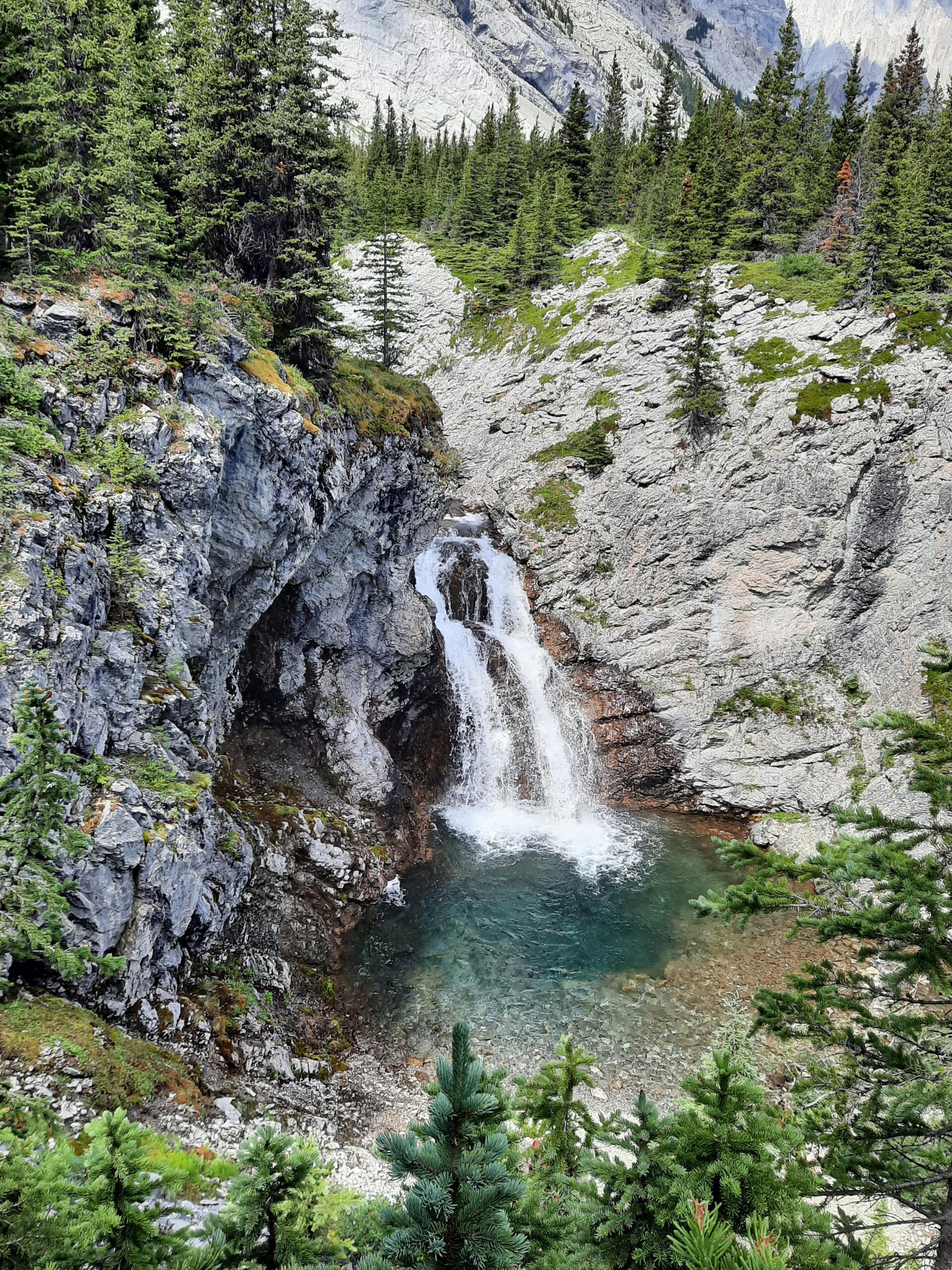
BLACK PRINCE CIRQUE
Distance in and out: 4.2 km
Elevation gain: 90 m
Time to complete: 1.5 to 2 hours
Difficulty: Easy
Black Prince Cirque offers one of the shortest and most accessible alpine-basin experiences in Peter Lougheed. Alberta Parks describes it as a trail that climbs to a seasonally variable cirque lake through forested and open areas, with the first section following an old logging road. That description fits the hike well. The approach is easy, the climb is modest, and the upper cirque gives a real sense of mountain enclosure without requiring much exertion.
What makes this route special is the amphitheater-like shape of the basin. The cirque walls gather around the upper area in a way that makes the hike feel more alpine than its numbers suggest. It is not a huge outing, but it does not feel trivial either. There is enough transition from forest to open terrain that the day still has a satisfying progression. Recent public descriptions of the interpretive trail pamphlet also emphasize the educational and geological side of the route, which suits its role as one of the best short alpine introductions in the park.
Black Prince works especially well for visitors who want scenery without a long climb, for mixed-ability groups, or for days when a shorter alpine outing makes more sense than a larger objective. It is one of the easiest ways to experience Peter Lougheed’s cirque-and-basin terrain without committing to a full mountain day.
Learn More About Our Half-Day Black Prince Hike in Kananaskis
ELK PASS
Distance in and out: 11 km
Elevation gain: 210 m
Time to complete: 3 to 4 hours
Difficulty: Moderate
Elk Pass sits near the southern boundary of the park and is one of the more useful connector-style hikes in Peter Lougheed. Alberta Parks notes that some trails in the park provide access to Elk Lakes Provincial Park in British Columbia, and Elk Pass is one of the most obvious expressions of that cross-boundary geography. The hiking here is less about a single dramatic summit and more about moving through a pass system that opens one mountain region into another.
The trail climbs gradually, which makes it appealing for hikers who prefer a steadier day. Rather than fighting for every metre of elevation, you move through forest and into more open terrain near the pass, where the sense of scale widens. Pass hikes like this often feel less concentrated than lake or summit hikes, but that is also why they can be so rewarding. The value lies in the transition between valleys and the feeling of crossing through the landscape rather than just arriving at one point on it. (alltrails.com)
Elk Pass suits hikers who want a moderate day with good movement, broad scenery, and a slightly more exploratory feel than some of the park’s better-known lake routes. It also works well as part of a larger mental map of the southern Kananaskis system, where valleys, passes, and provincial park boundaries all connect

UPPER KANANASKIS LAKE SHORELINE
Distance in and out: 15.7 km
Elevation gain: minimal
Time to complete: 4 to 5 hours
Difficulty: Moderate
Not every memorable hike in Peter Lougheed requires a large elevation gain. Alberta Parks describes the Upper Lake Trail as a route that circumnavigates Upper Kananaskis Lake, passes Sarrail Falls only 1.1 km from the Upper Lake Day Use area, and continues through stands of spruce and fir, with the north side crossing the Palliser rockslide. That alone makes it much more than a simple “flat lake walk.” It is a long shoreline circuit with changing terrain and multiple visual moods.
What makes the Upper Lake shoreline so good is how consistently scenic it is without ever becoming rushed. The turquoise water is present almost from the beginning, and the surrounding peaks give the whole outing a strong mountain frame even though you stay relatively low. The lake’s length also means the day unfolds in sections: falls, forest, shoreline, rockslide, and long lake views. That variety helps the hike feel substantial even without the concentrated exertion of a steep climb.
This is an excellent route for hikers easing into mountain terrain, for visitors who want to spend real time beside one of the park’s most beautiful lakes, or for anyone who prefers distance and scenery over elevation gain. It is also a very good example of how Peter Lougheed can deliver a memorable day without always pushing people upward.
Learn More About Our Full-Day Upper Kananaskis Lakes Hike
LOWER KANANASKIS LAKES TRAILS
Distance in and out: 7 km
Elevation gain: minimal
Time to complete: 1.5 to 2 hours
Difficulty: Easy
The trails around Lower Kananaskis Lake provide a gentler lakeside outing than the full Upper Lake circuit while still giving the strong water-and-peak scenery that defines this part of the park. Alberta Parks says the Lower Lake Trail connects Canyon Day Use to the Bill Benson Trail near William Watson Lodge via a 3.5 km walk near the shoreline, and it also offers a shorter Lower Lake Interpretive Trail through mature subalpine forest. That range is part of the appeal. You can keep the day easy and short or shape it into a slightly fuller walk depending on what you need.
This is not a dramatic alpine hike, and it does not need to be. The value here is in accessibility, calm water views, and the way the lake basin lets the mountain skyline do the work. Early morning and evening light tend to be especially good here, when the water surface and the valley atmosphere soften the whole scene. For many visitors, Lower Kananaskis works well as an easier first outing or as a recovery day between bigger hikes.
Lower Lake is best for hikers who want scenery without pressure, or for days when energy, weather, or timing make a simpler plan the smarter one. That kind of day still matters, especially on a multi-day Rockies trip.
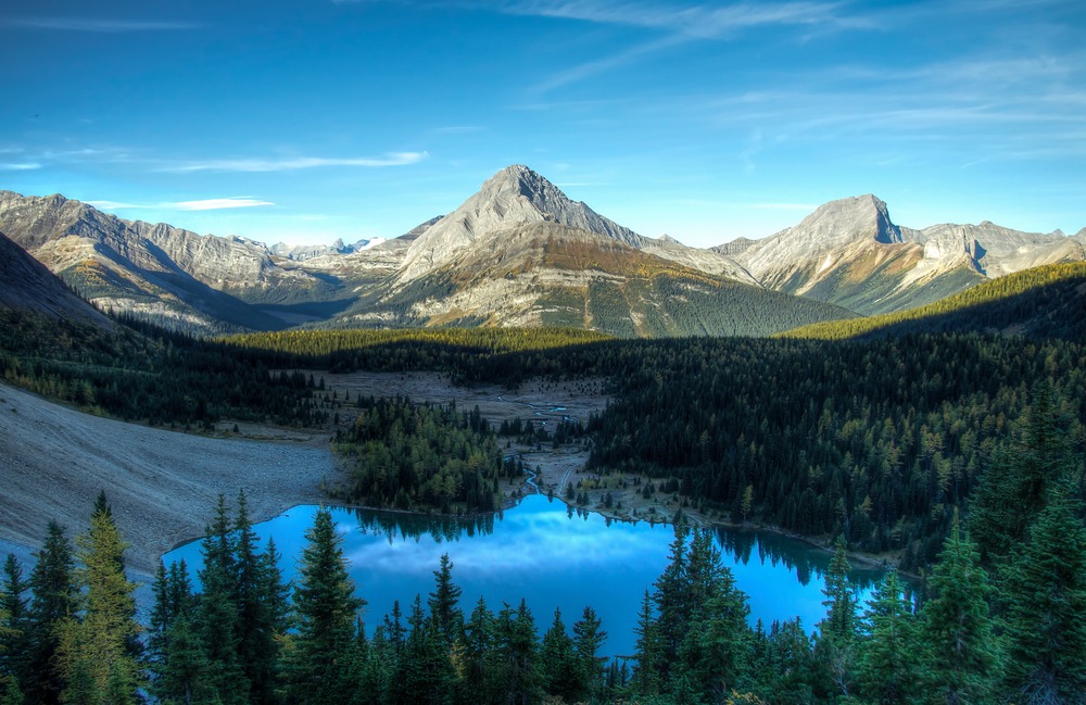
THREE ISLE LAKE
Distance in and out: 15 km
Elevation gain: 600 m
Time to complete: 5 to 6 hours
Difficulty: Challenging
Three Isle Lake lies deeper in the backcountry than most of the other hikes on this page, and Alberta Parks confirms that the most direct access to the Three Isle backcountry campground is from North Interlakes Day Use via the Upper Kananaskis Lake Circuit / Three Isle Lake Trail, with the campground 10.3 km from the day use area. That tells you immediately that this is not a short scenic stroll. It is a longer mountain day that moves well beyond the front-country feel of the park’s easier trails.
The route begins by traversing the north side of Upper Kananaskis Lake, then gradually pushes farther into the valley system and into a larger alpine basin. That longer lead-in is part of what makes Three Isle Lake feel quieter and more backcountry in character than hikes like Rawson or Chester. By the time you reach the lake, the setting feels set back from the main corridor rather than simply adjacent to it. That extra depth is part of the reward.
Many backpackers continue beyond the lake toward Northover Ridge, which adds to the route’s reputation. Even as a day hike, though, Three Isle stands on its own as one of the strongest longer lake objectives in Peter Lougheed. It is best for hikers who want a full alpine day and who are comfortable trading quick payoff for a deeper, quieter mountain setting.
WHICH PETER LOUGHEED HIKES SUIT DIFFERENT TYPES OF DAYS?
Some routes in the park work best as shorter scenic outings, while others create a fuller alpine day. Black Prince Cirque and the lakeshore trails around Upper and Lower Kananaskis Lakes are excellent options for visitors wanting beautiful scenery without a steep climb. Black Prince is the shortest true alpine basin experience. Lower Lake is the gentlest lakeside option. Upper Lake is the better choice if you want a longer, more immersive shoreline day.
Rawson Lake and Chester Lake suit hikers looking for moderate half-day routes with strong mountain scenery. Rawson is the more enclosed and dramatic alpine lake. Chester is the broader, meadow-based basin hike and often the stronger choice during larch season. Elk Pass sits a little differently, working more as a moderate pass and connector day than a destination-lake outing.
Burstall Pass, Three Isle Lake, and Sarrail Ridge are better choices for those wanting longer or more demanding days in alpine terrain. Burstall is the best long valley-and-pass day. Three Isle is the best deeper backcountry-style lake hike. Sarrail Ridge is the one to choose if the goal is a dramatic viewpoint above the lake system. Choosing between them depends less on which one is most famous and more on what kind of effort and terrain you want the day to hold. That is exactly where How to Pace a Hike in the Canadian Rockies becomes useful.
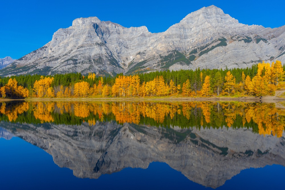
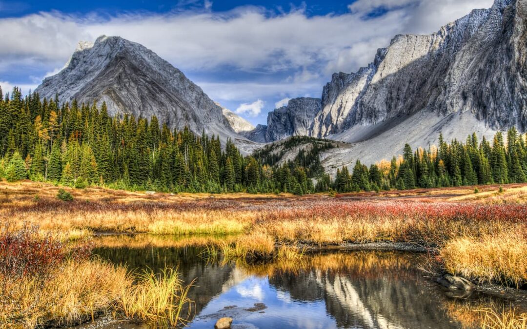
LARCH SEASON IN PETER LOUGHEED PROVINCIAL PARK
Early autumn is one of the most beautiful times to hike in this part of Kananaskis. Valleys such as Chester Lake and Burstall Pass contain extensive stands of alpine larch that turn brilliant gold for a short period each September, and current route descriptions still consistently identify these as among the park’s best larch-season hikes. Because both routes are already strong hikes outside larch season, the autumn color feels like an added layer rather than the only reason to go.
Because the window is brief, these trails can become popular during peak larch season. Starting early, choosing a weekday, or selecting a longer route often leads to a calmer experience. For broader seasonal timing, Best Time to Visit Kananaskis for Hiking is the most relevant internal companion.
PLANNING A HIKING DAY IN PETER LOUGHEED PROVINCIAL PARK
Because the park sits at relatively high elevation, conditions can change quickly throughout the hiking season. Alberta Parks’ current Peter Lougheed trail report warns visitors to come prepared for a variety of conditions that can change suddenly through the day and notes the possible need for poles, microspikes, warm layers, and extra caution around creeks and wet areas. That kind of official warning is especially relevant here because Peter Lougheed often looks straightforward on paper while still behaving like real mountain terrain.
Snow can linger in alpine terrain into early summer, while autumn storms can arrive earlier than many visitors expect. Seasonal timing matters here more than many travelers realize, especially for pass and ridge routes. For broader Rockies context, see Banff Weather by Month. If you are exploring beyond this valley, Kananaskis Country: Alberta’s Provincial Parks provides the best wider overview of how the surrounding parks fit together.
Visitors should also remember that parking within Kananaskis Country requires a Kananaskis Conservation Pass, a point Alberta Parks repeats across the park’s trails, day-use areas, and campground access pages.
WHAT TO KNOW BEFORE SETTING OUT
Peter Lougheed lies within active wildlife habitat, and Alberta Parks currently notes wildlife-related advisories in parts of the park, including denning closures and access cautions around certain undesignated routes and bridges. Even when the specific trail you want is open, that broader context matters. This is a busy recreation area layered over real mountain habitat, not a managed landscape where wildlife concerns stay invisible.
Carrying bear spray, checking current trail reports, and choosing routes that match both the season and your pace can make the day far more comfortable. Distances between trailheads and day-use areas can also be larger than they first appear on a map. In a park this large, it often works better to choose one part of the valley system to explore each day rather than trying to bounce between multiple trailheads. That usually creates a calmer and more enjoyable experience overall.
A DIFFERENT KIND OF ROCKIES EXPERIENCE
Peter Lougheed Provincial Park offers one of the strongest combinations of alpine lakes, broad valleys, and approachable mountain hiking anywhere in Kananaskis Country. The variety of landscapes, from lakeshore walks to high passes and backcountry lake routes, allows hikers to experience the mountains in several different ways without leaving the same park system. That range is part of why the area stays memorable. It can feel generous rather than singular.
For many visitors exploring Kananaskis, these valleys and basins become some of the most memorable parts of a Rockies trip. And because visitor patterns shape how these days feel on the ground, Why Popular Hikes in Banff Feel Crowded is a useful related read when you are thinking about timing and expectations.
A GUIDE’S PERSPECTIVE
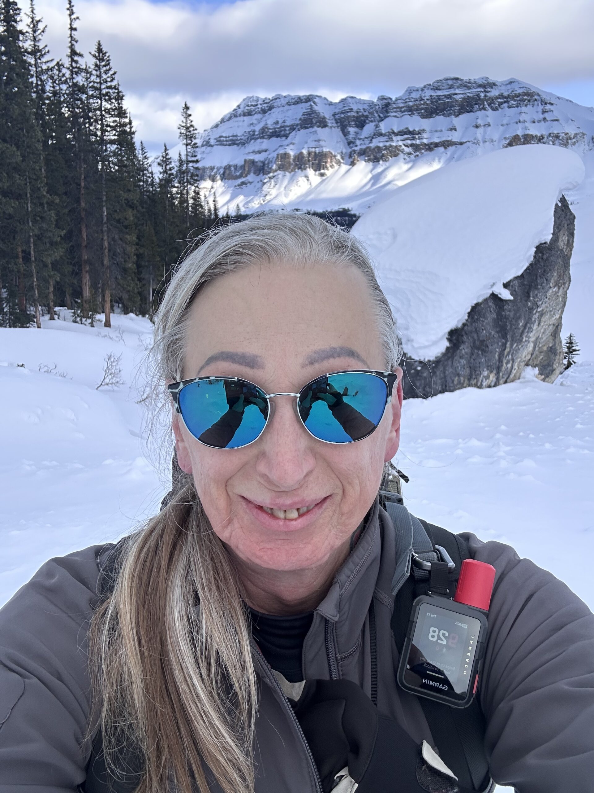
As a private hiking guide working across the Canadian Rockies, I spend much of the season moving through landscapes like these with guests who want a steady, well-paced day in the mountains.
Areas such as Peter Lougheed are often chosen not only for their scenery, but for how terrain, timing, and visitor patterns shape the rhythm of a hiking day. The same park can offer a gentle lakeshore walk, a moderate alpine lake, or a long backcountry-feeling day, and part of good route choice is understanding which of those actually fits the conditions and the people on trail. That is part of how thoughtful mountain days are designed.
If you prefer exploring these landscapes with experienced judgment and a calm, adaptable pace, you can learn more about my private guided hiking experiences in Kananaskis.
FREQUENTLY ASKED QUESTIONS ABOUT PETER LOUGHEED PROVINCIAL PARK HIKES
What are the best hikes in Peter Lougheed Provincial Park?
Popular choices include Rawson Lake, Chester Lake, Burstall Pass, Black Prince Cirque, and Three Isle Lake. Each offers a different kind of day, from shorter scenic outings to longer alpine routes.
Are these hikes suitable for moderate hikers?
Many are. Trails such as Rawson Lake, Chester Lake, Elk Pass, and the lakeshore routes offer strong scenery without requiring extreme difficulty. Longer routes like Three Isle Lake or steeper climbs such as Sarrail Ridge are better for hikers comfortable with a more demanding day.
When are these hikes usually snow-free?
Most trails are most reliably accessible from late June through early October, although timing varies with snowpack and elevation. Higher terrain and shaded alpine basins may hold snow longer into early summer. Alberta Parks advises checking current trail reports because conditions can change quickly.
Do I need a Kananaskis Conservation Pass?
Yes. Most parking areas within Kananaskis Country require a Kananaskis Conservation Pass, which supports trail maintenance and park management across the region.
Certified private hiking guide and professional interpretive practitioner based in the Canadian Rockies. With over 25 years of four-season mountain experience, she offers thoughtfully paced hiking experiences that help active adults explore mountain landscapes with care, confidence, and understanding. Meet Niki