Many visitors planning a trip to the Canadian Rockies focus first on Banff National Park or Lake Louise. Those landscapes are extraordinary, but they also concentrate a large share of the region’s visitors.
Just south of Banff lies another mountain region that offers equally dramatic terrain with a very different rhythm.
Peter Lougheed Provincial Park sits in the heart of Kananaskis Country, a vast network of provincial parks protecting valleys, ridgelines, forests, and alpine basins along the eastern slopes of the Canadian Rockies. Here, hikers often find the same sweeping mountain scenery that defines Banff, but with trails that feel calmer and landscapes that unfold at a steadier pace.
For travelers who enjoy experiencing mountains without rushing from viewpoint to viewpoint, Peter Lougheed Provincial Park hiking offers some of the most rewarding landscapes in Alberta.
To understand how this park fits into the wider region, see Kananaskis Country: Alberta’s Provincial Parks, which explores the broader network of provincial mountain parks surrounding Banff.
The Landscape of Peter Lougheed Provincial Park
Peter Lougheed Provincial Park protects one of the most recognizable alpine landscapes in Kananaskis Country.
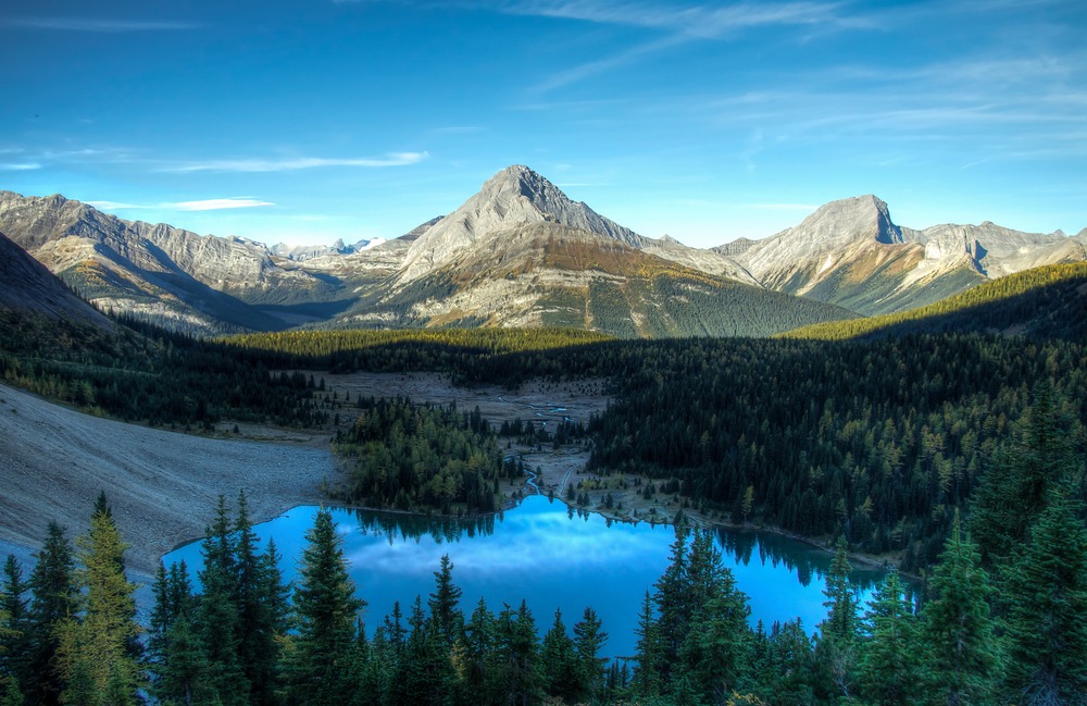
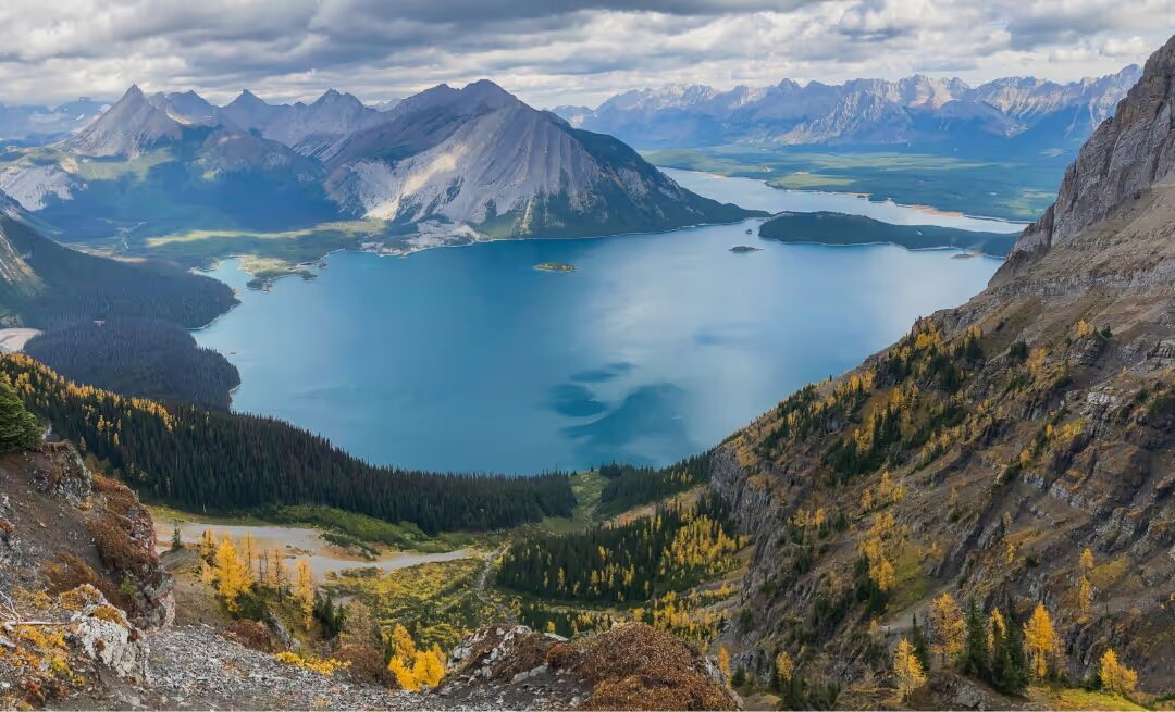
The park centers around the Upper and Lower Kananaskis Lakes, two large glacial lakes framed by steep mountain walls and broad valleys. From these lakes, trails extend into alpine basins, forested ridges, and high mountain passes that provide access to some of the most scenic hiking terrain in the region.
Compared with the steep, compact terrain around Lake Louise, the valleys here often feel wider and more open. Trails frequently follow river corridors or gradual slopes before climbing toward alpine viewpoints. That geography naturally spreads hikers across the landscape, allowing many trails to feel quieter even during the summer season.
The result is a hiking experience where the scenery unfolds gradually, lakes first, then forests, then expansive alpine views above the valley floor.
History of the Kananaskis Lakes Valley
Long before the creation of provincial parks, the valleys surrounding Kananaskis Lakes were part of seasonal travel routes used by Indigenous peoples moving through the eastern slopes of the Rockies. These mountain corridors connected hunting grounds and traditional travel routes across the region.
The park itself was established in 1977 and named after Peter Lougheed, the former premier of Alberta whose government played a significant role in expanding the provincial parks system. His vision helped protect large areas of mountain landscape outside Banff National Park, ensuring that places like Kananaskis remained accessible for recreation while preserving wildlife habitat and natural ecosystems.
Today the park remains one of the most visited areas within Kananaskis Country, yet it still retains a sense of spaciousness that many visitors find refreshing compared with the busiest national park corridors.
Ecology and Wildlife in the Park
The landscapes within Peter Lougheed Provincial Park form part of a critical wildlife corridor connecting Banff National Park with the southern ranges of Kananaskis.
Because the park protects large continuous valleys and forest systems, it supports a wide variety of wildlife. Elk and deer are frequently seen in the valley bottoms, while black bears and grizzly bears move through the region seasonally following food sources such as berries and roots.
Higher elevations transition into subalpine ecosystems, where spruce and fir forests give way to alpine meadows filled with wildflowers during the summer months.
These ecosystems are delicate and shaped by short growing seasons, which is why responsible travel practices such as Leave No Trace play an important role in protecting the landscape.
Geology of the Front Ranges
The mountains surrounding Peter Lougheed Provincial Park are part of the Front Ranges of the Canadian Rockies, a region formed during massive tectonic compression roughly 80 million years ago.
During that period, layers of ancient seabed rock were pushed eastward over younger rock layers in a process known as thrust faulting. Over millions of years, glaciers carved the wide valleys and cirques that hikers experience today.
The large glacial basins surrounding Kananaskis Lakes are the result of repeated glaciation during the last ice age. As glaciers advanced and retreated, they sculpted the valleys into the U-shaped forms that define much of the landscape.
These geological processes are why the terrain feels expansive here. Glacial valleys often create broader landscapes than the steep canyon-like terrain seen in other parts of the Rockies.
Scenic Hiking Routes in Peter Lougheed Provincial Park
The park contains a wide variety of hiking terrain ranging from lakeshore walks to alpine ridge routes.
Several landscapes consistently stand out for visitors exploring the region.
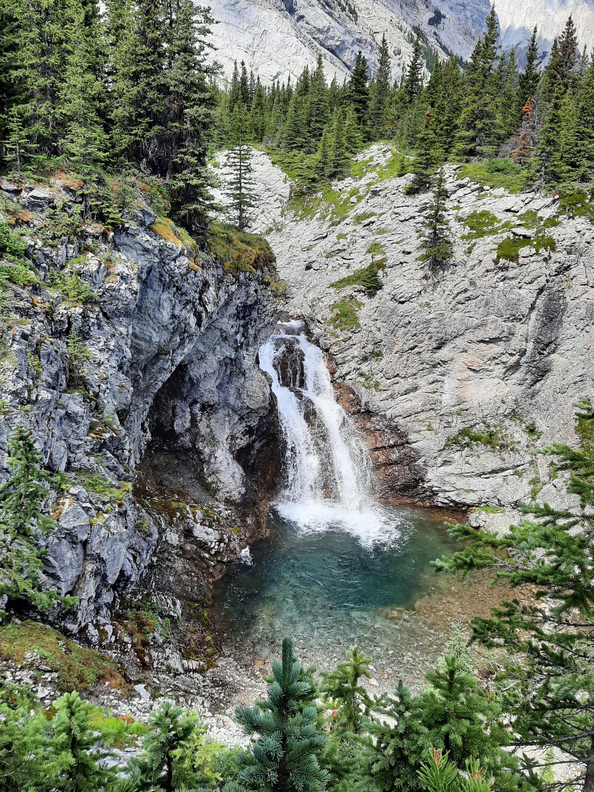
Rawson Lake and Sarrail Ridge
One of the most recognizable hikes in the park climbs above Upper Kananaskis Lake toward Rawson Lake, a deep turquoise alpine lake surrounded by steep mountain walls.
Beyond the lake, the route toward Sarrail Ridge rises into alpine terrain with sweeping views across the Kananaskis valley system.
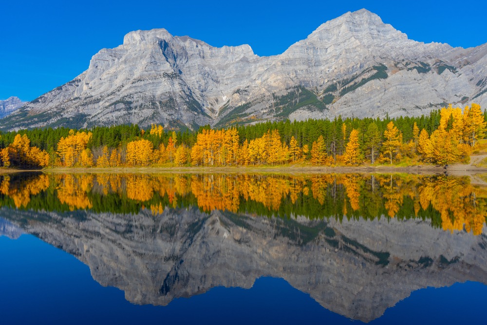
Chester Lake
Located near the park’s northern boundary, Chester Lake sits within a broad alpine valley that becomes especially beautiful during autumn larch season.
Upper Kananaskis Lakes Shoreline
Not every memorable hike in the park requires significant elevation gain. The shoreline trails around Upper Kananaskis Lake offer remarkable mountain views with relatively gentle terrain.
Because the lakes sit deep within the valley, the scenery often feels immersive from the very first steps.
Seasonal Character of the Park
Like most areas of the Canadian Rockies, the character of Peter Lougheed Provincial Park changes dramatically with the seasons.
Spring often arrives slowly at higher elevations, with snow lingering in alpine basins well into June.
Summer brings long daylight hours and vibrant alpine landscapes, especially when wildflowers bloom across the subalpine meadows.
Autumn introduces cooler temperatures and the golden glow of larch trees, which draw photographers and hikers from across the region.
Winter transforms the park into a snow-covered landscape popular with cross-country skiers and snowshoers.
Because weather patterns in the Rockies can shift quickly, it helps to understand seasonal conditions before planning a hike. Resources such as Banff Weather by Month can help visitors anticipate how conditions change throughout the year.
Why This Park Often Feels Different from Banff
While Banff National Park attracts millions of visitors each year, the provincial parks of Kananaskis Country often distribute visitors across a much larger network of valleys and trailheads.
The result is that many hikes here feel calmer even during the height of summer.
Several factors contribute to this difference:
• fewer iconic photo viewpoints concentrating visitors
• wider valleys that naturally disperse hikers
• trailheads spread across a large geographic area
• less shuttle-based access compared with Lake Louise
This dynamic is explored further in Why Popular Hikes in Banff Feel Crowded, which explains how visitor patterns shape the hiking experience across the Rockies.
A Guide’s Perspective on Hiking Here
After guiding in the Canadian Rockies for many seasons, I’ve found that places like Peter Lougheed Provincial Park often produce some of the most memorable mountain days.
The terrain encourages a steady pace, and the landscapes feel expansive rather than compressed. Many hikers find that the experience becomes less about reaching a single destination and more about moving through the mountains themselves.
When guests join me for a private guided hike, these kinds of landscapes often allow the day to unfold naturally, with time to notice the terrain, pause beside alpine lakes, and experience the quiet character that makes Kananaskis so special.
If this part of Kananaskis feels like the right fit for your trip, you can explore my private guided hiking options here.
How This Park Fits Into a Rockies Trip
For many travelers, Peter Lougheed Provincial Park becomes a valuable addition to a Canadian Rockies itinerary.
Because the park sits roughly an hour from Calgary and just south of Banff, it can easily complement time spent exploring Banff National Park or the Icefields Parkway.
Some visitors choose to begin their trip in Kananaskis to ease into mountain hiking before exploring higher alpine areas near Lake Louise. Others add a day here simply to experience a quieter side of the Rockies.
Either way, the park provides a powerful reminder that some of the most beautiful landscapes in Alberta lie just beyond the most famous destinations.
Frequently Asked Questions About Peter Lougheed Provincial Park Hiking
What are the best hikes in Peter Lougheed Provincial Park?
Popular choices include Rawson Lake, Chester Lake, Burstall Pass, Black Prince Cirque, and Three Isle Lake. Each offers a different kind of day, from shorter scenic outings to longer alpine routes.
Are these hikes suitable for moderate hikers?
Many are. Trails such as Rawson Lake, Chester Lake, Elk Pass, and the lakeshore routes offer strong scenery without requiring extreme difficulty. Longer routes like Three Isle Lake or steeper climbs such as Sarrail Ridge are better for hikers comfortable with a more demanding day.
When are these hikes usually snow-free?
Most trails are most reliably accessible from late June through early October, although timing varies with snowpack and elevation. Higher terrain and shaded alpine basins may hold snow longer into early summer.
Do I need a Kananaskis Conservation Pass?
Yes. Most parking areas within Kananaskis Country require a Kananaskis Conservation Pass, which supports trail maintenance and park management across the region.
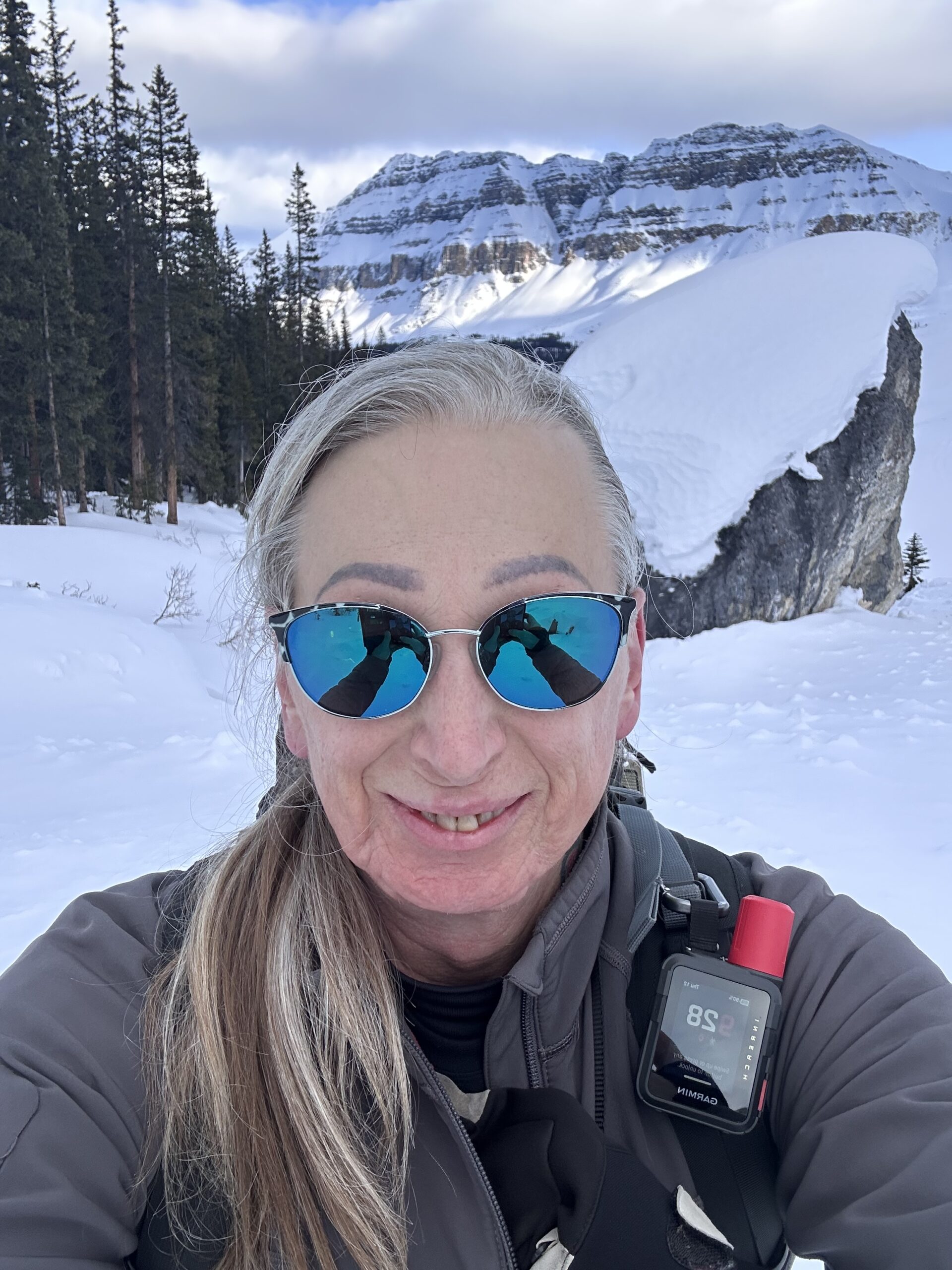
Certified private hiking guide and professional interpretive practitioner based in the Canadian Rockies. With over 25 years of four-season mountain experience, she offers thoughtfully paced hiking experiences that help active adults explore mountain landscapes with care, confidence, and understanding. Meet Niki