Alpine Ridges and Wildflower Basins in Kananaskis Country
Many travellers exploring the Canadian Rockies begin their journey in Banff National Park or Lake Louise. Those landscapes are deservedly famous, but just south of Banff lies another mountain corridor that offers a very different experience.
Highwood Pass sits along the southern edge of Kananaskis Country and marks the highest paved mountain pass in Canada. At more than 2,200 meters above sea level, the pass provides direct access to alpine terrain that would normally require hours of climbing to reach.
Here the forests thin, ridgelines rise sharply from open basins, and sweeping mountain views appear almost immediately from the trailhead. For hikers, this creates a rare opportunity to experience the alpine landscapes of the Canadian Rockies with relatively modest effort.
For visitors who enjoy expansive ridgelines, wildflower-filled slopes, and a sense of elevation that defines the high mountains, hiking near Highwood Pass offers some of the most dramatic terrain in southern Kananaskis.
To understand how this area fits into the wider region, see Hiking Kananaskis Country: Alberta’s Provincial Parks, which explores the broader network of provincial mountain parks surrounding Banff.
For a broader view of how areas like this fit into a Rockies trip, see How to Plan a Trip to the Canadian Rockies, where terrain, distance, and pacing are considered together.
THE LANDSCAPE OF HIGHWOOD PASS
Highwood Pass lies along Highway 40 between the Kananaskis Lakes valley to the north and the rolling foothills that descend toward southern Alberta.
Unlike the deep glacial valleys surrounding Kananaskis Lakes or Spray Valley, the terrain around Highwood Pass sits directly along the crest of the Front Ranges. This means the landscape transitions quickly from forest to open alpine terrain.
Low subalpine forests surround the road, but within a short distance the terrain opens into broad alpine basins, rocky cirques, and sweeping ridgelines. From many trails, hikers gain views across multiple mountain valleys stretching toward both the continental divide and the eastern foothills.
Because the pass sits at such high elevation, the alpine environment arrives quickly. In many places hikers step directly from the trailhead into landscapes normally associated with far longer mountain approaches.
WHY HIGHWOOD PASS IS UNIQUE
One of the defining features of Highwood Pass is its elevation.
At approximately 2,206 meters above sea level, it is the highest paved pass in Canada. This elevation places visitors immediately within the subalpine and alpine zones of the Rocky Mountains.
The result is a landscape where many classic alpine features appear almost immediately:
• open meadows above treeline
• rocky cirques carved by glaciers
• ridgelines overlooking multiple valleys
• wildflower slopes during summer
For hikers, this means relatively short trails can still provide expansive mountain views.
This accessibility makes Highwood Pass one of the most remarkable alpine environments reachable by road in the Canadian Rockies.
ECOLOGY OF THE ALPINE ENVIRONMENT
The ecosystems surrounding Highwood Pass reflect the harsh conditions of high elevation environments.
Short summers, strong winds, and deep winter snowpack limit the types of plants that can survive here. Subalpine spruce and fir forests grow along the lower slopes, but as elevation increases the trees gradually disappear, giving way to alpine tundra.
These alpine landscapes support hardy plant species that have adapted to extremely short growing seasons. Wildflowers often bloom quickly after snowmelt, creating colorful alpine meadows across the slopes during mid-summer.
You can explore this in more detail in Wildflowers in Kananaskis, where bloom timing and elevation patterns are explained more fully.
Wildlife also moves through this terrain seasonally. Mountain goats, bighorn sheep, and marmots are occasionally seen among the rocky ridges, while birds such as ptarmigan inhabit the higher alpine basins.
Because the growing season is short and fragile, hikers are encouraged to remain on established trails whenever possible to protect these delicate alpine ecosystems.
GEOLOGY OF THE HIGHWOOD PASS REGION
The mountains surrounding Highwood Pass belong to the Front Ranges of the Canadian Rockies, a region formed through powerful tectonic compression millions of years ago.
During this process, massive layers of ancient seabed rock were pushed eastward along large fault lines. Over time, erosion and glaciation carved the ridges and basins visible today.
Glaciers played a particularly important role in shaping the landscape around Highwood Pass. Ice carved the cirques and alpine valleys that now form many of the hiking areas surrounding the pass.
These glacial processes created the broad alpine basins and dramatic ridge systems that make the area so visually striking today.
SCENIC LANDSCAPES AND HIKING AREAS
Several alpine landscapes around Highwood Pass have become especially popular for hikers exploring southern Kananaskis.
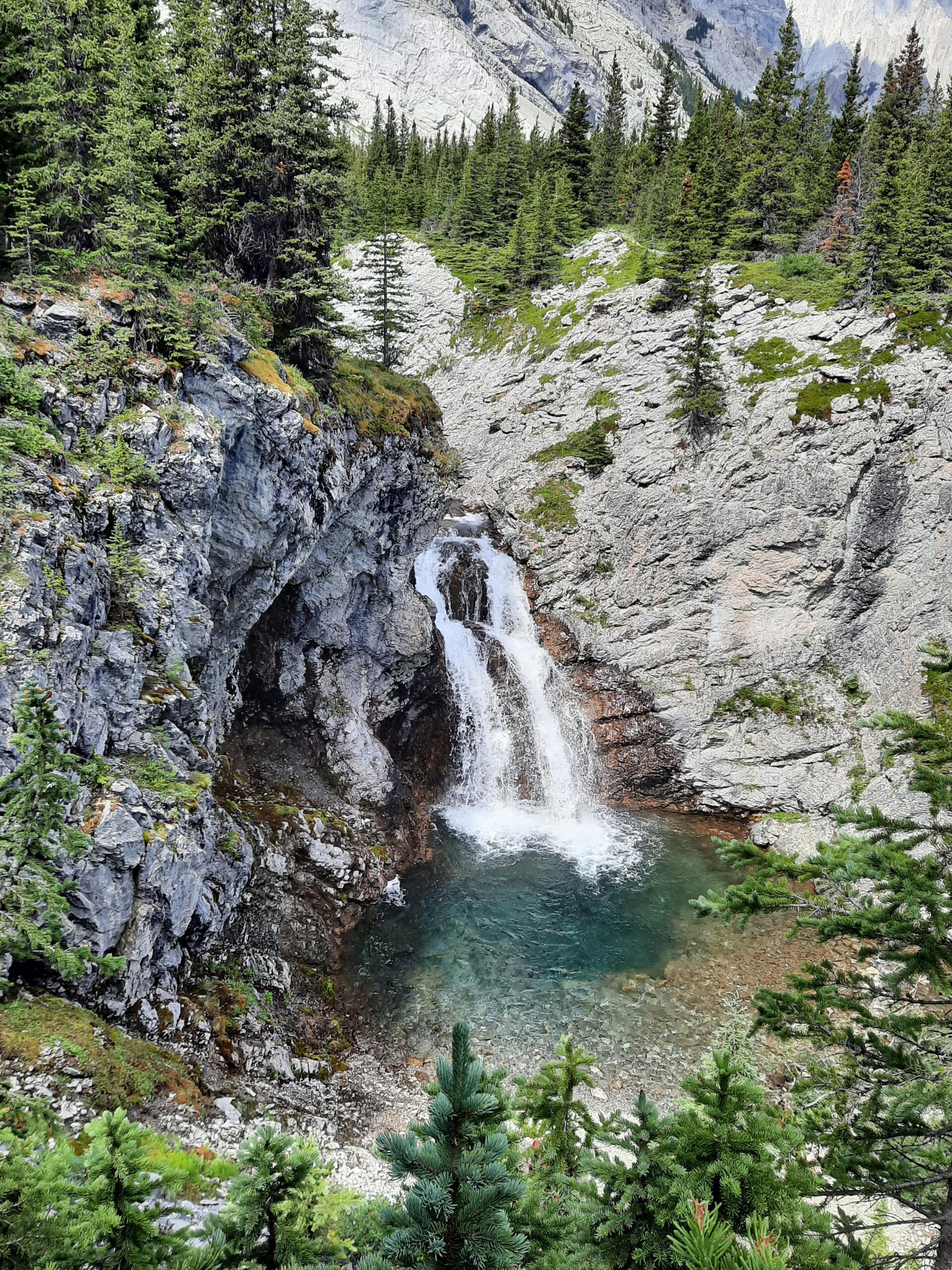
Ptarmigan Cirque
A short climb from the pass leads into a classic glacial cirque basin surrounded by rugged peaks and alpine meadows.
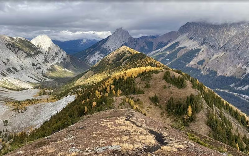
Pocaterra Ridge
One of the most scenic ridge walks in Kananaskis, offering sweeping views across the Front Ranges and deep mountain valleys.
Arethusa Cirque
An alpine basin known for vibrant wildflower displays during mid-summer.
Grizzly Ridge
A dramatic ridge route providing expansive mountain views and access to open alpine terrain.
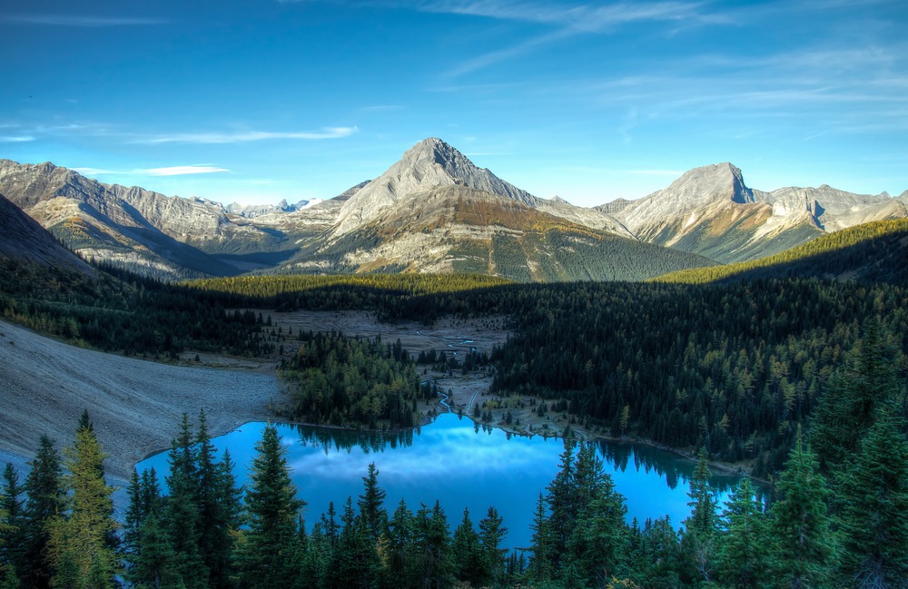
Picklejar Lakes
A series of alpine lakes nestled beneath high mountain slopes along the southern end of the pass.
You can explore these routes in more detail in Highwood Pass Hiking | Best Alpine Trails and Ridge Walks.
SEASONAL CHARACTER OF HIGHWOOD PASS
Because of its elevation, the character of Highwood Pass changes dramatically throughout the year.
Spring arrives slowly in this alpine environment. Snow often lingers on north-facing slopes and within cirques well into early summer.
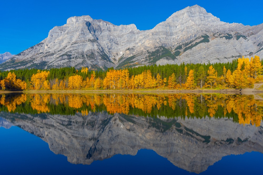
Summer brings some of the most vibrant landscapes in the region. As snow retreats from alpine slopes, wildflowers begin appearing across meadows and rocky basins.
Late summer and early autumn provide crisp air and clear mountain views, while nearby valleys begin showing the golden colors of larch season.
Winter conditions arrive early at this elevation, and the highway through Highwood Pass typically closes seasonally to protect wildlife and maintain safety during heavy snowfall.
Understanding these seasonal patterns helps visitors choose the right time to explore the area.
For a broader seasonal breakdown across the region, see Best Time to Visit Kananaskis for Hiking.
WHY THIS AREA FEELS DIFFERENT FROM OTHER PARTS OF KANANASKIS
Many hiking areas in Kananaskis begin in forested valleys before gradually climbing into alpine terrain.
Highwood Pass reverses that experience.
Because the road already sits at high elevation, hikers reach open alpine landscapes almost immediately. The result is a mountain experience where expansive views arrive quickly and the sense of elevation is constant throughout the day.
This creates a style of hiking that feels very different from the deeper valley systems of Peter Lougheed Provincial Park or Spray Valley.
For many visitors, this immediate immersion in alpine terrain is what makes Highwood Pass so memorable.
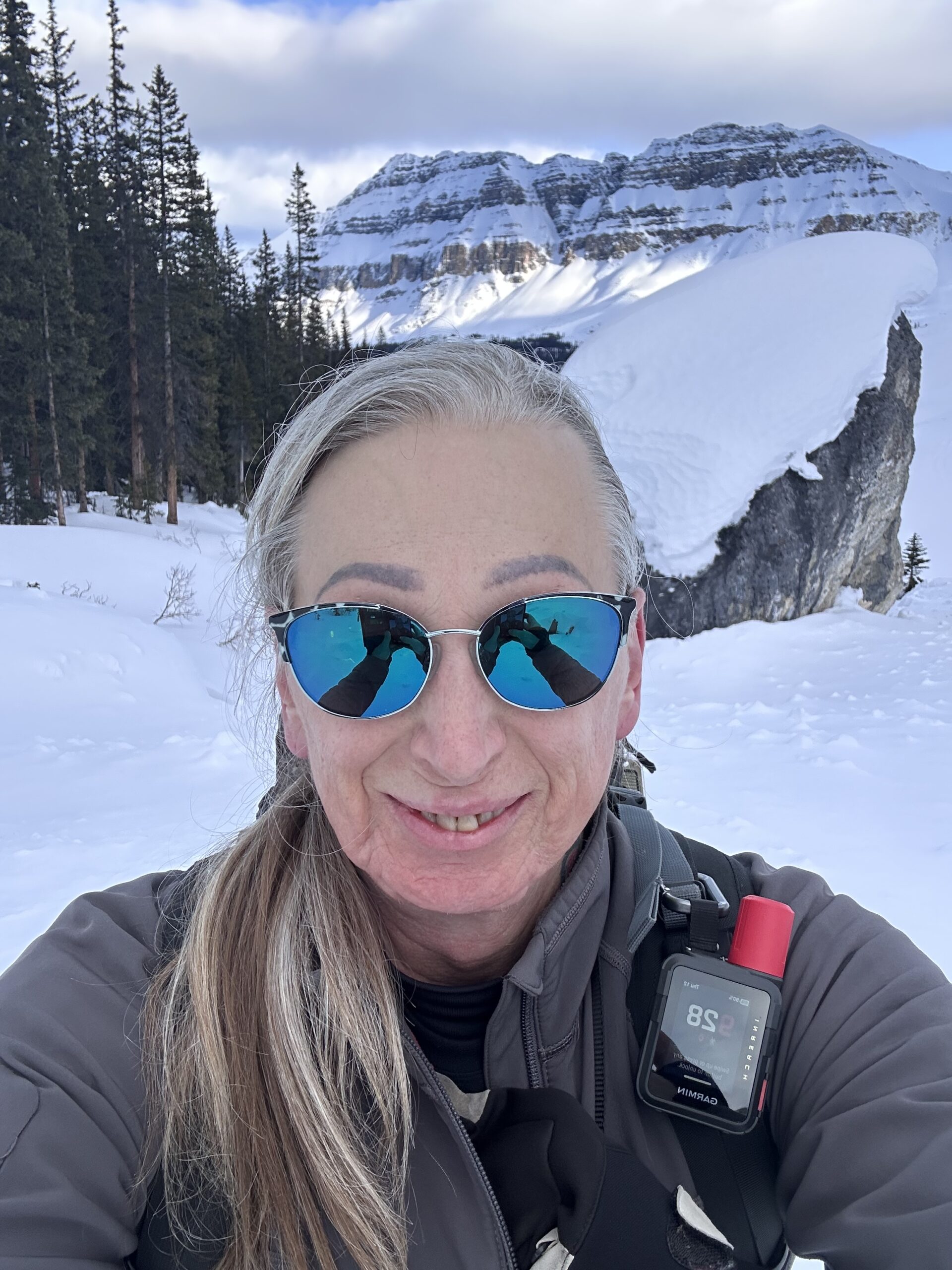
A GUIDE’S PERSPECTIVE ON HIKING HERE
After guiding in the Canadian Rockies for many seasons, Highwood Pass has always stood out as one of the most distinctive landscapes in Kananaskis Country.
Few places allow hikers to access such expansive alpine terrain so quickly. Within a short distance from the trailhead, the forests fall away and the mountains open into sweeping ridgelines and wildflower basins.
For guests joining me on private guided hikes, these landscapes often create a different rhythm to the day. Instead of long forest approaches, the focus shifts quickly to the alpine environment itself, observing the terrain, noticing the seasonal changes, and moving through the mountains at a thoughtful pace.
If you’d like help choosing and planning the right hike in Kananaskis, see my private guided hiking services.
This is also where pacing becomes important. I explore this further in How to Pace a Hike in the Canadian Rockies, where terrain, energy, and conditions shape how a day unfolds.
HOW HIGHWOOD PASS FITS INTO A ROCKIES TRIP
Because Highwood Pass lies along Highway 40 south of the main Kananaskis Lakes corridor, it is often explored as part of a broader Kananaskis itinerary.
Some travelers combine hikes here with time in Peter Lougheed Provincial Park or the Spray Valley, creating a varied experience across several different mountain landscapes.
Others visit specifically for the alpine terrain and seasonal wildflower displays that define the pass during summer.
Either way, Highwood Pass offers one of the most accessible ways to experience the high alpine environments of the Canadian Rockies.
FREQUENTLY ASKED QUESTIONS ABOUT HIGHWOOD PASS
Where is Highwood Pass located?
Highwood Pass lies along Highway 40 in southern Kananaskis Country, south of the Kananaskis Lakes valley and west of Longview, Alberta. It sits within one of the highest and most scenic road-access mountain corridors in the Canadian Rockies, making it a distinctive part of the wider Kananaskis region.
Why is Highwood Pass famous?
Highwood Pass is best known as the highest paved road in Canada. It also stands out because hikers can reach alpine ridges, wildflower basins, and expansive mountain views with far less climbing than in many other parts of the Rockies.
What are the best hiking areas near Highwood Pass?
Several alpine landscapes around the pass are especially popular, including Ptarmigan Cirque, Pocaterra Ridge, Arethusa Cirque, Grizzly Ridge, and Picklejar Lakes. For detailed trail descriptions, see Highwood Pass Hiking | Best Alpine Trails and Ridge Walks.
When is the best time to hike at Highwood Pass?
Most hiking trails near Highwood Pass are most accessible from late June through early October, depending on snowpack and seasonal weather patterns. Mid-summer is especially well known for alpine wildflowers, while early autumn often brings crisp air and clear mountain views.
Is Highwood Pass open year-round?
No. Highway 40 through Highwood Pass typically closes during the winter and reopens in early summer. Because access depends on the seasonal road opening, hikers should always check current conditions before planning a visit.
Certified private hiking guide and professional interpretive practitioner based in the Canadian Rockies. With over 25 years of four-season mountain experience, she offers thoughtfully paced hiking experiences that help active adults explore mountain landscapes with care, confidence, and understanding. Meet Niki